


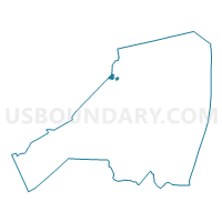
Aberdeen township voting district 13, Monmouth County, New Jersey
About
Outline

Summary
| Unique Area Identifier | 620725 |
| Name | Aberdeen township voting district 13 |
| County | Monmouth County |
| State | New Jersey |
| Area (square miles) | 0.79 |
| Land Area (square miles) | 0.76 |
| Water Area (square miles) | 0.04 |
| % of Land Area | 95.38 |
| % of Water Area | 4.62 |
| Latitude of the Internal Point | 40.39781080 |
| Longtitude of the Internal Point | -74.24484100 |
Maps

Graphs
Select a template below for downloading or customizing gragh for Aberdeen township voting district 13, Monmouth County, New Jersey


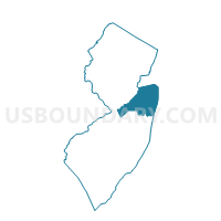
Neighbors
Neighoring Voting District (by Name) Neighboring Voting District on the Map
- Aberdeen township voting district 12, Monmouth County, NJ
- Aberdeen township voting district 5, Monmouth County, NJ
- Aberdeen township voting district 9, Monmouth County, NJ
- Marlboro township voting district 26, Monmouth County, NJ
- Marlboro township voting district 9, Monmouth County, NJ
- Matawan borough voting district 3, Monmouth County, NJ
- Matawan borough voting district 4, Monmouth County, NJ
- Old Bridge township ward 2 voting district 2, Middlesex County, NJ
- Old Bridge township ward 2 voting district 3, Middlesex County, NJ
- Old Bridge township ward 2 voting district 5, Middlesex County, NJ
Top 10 Neighboring County Subdivision (by Population) Neighboring County Subdivision on the Map
- Old Bridge township, Middlesex County, NJ (65,375)
- Marlboro township, Monmouth County, NJ (40,191)
- Aberdeen township, Monmouth County, NJ (18,210)
- Matawan borough, Monmouth County, NJ (8,810)
Top 10 Neighboring Place (by Population) Neighboring Place on the Map
Top 10 Neighboring Elementary School District (by Population) Neighboring Elementary School District on the Map
Top 10 Neighboring Secondary School District (by Population) Neighboring Secondary School District on the Map
Top 10 Neighboring Unified School District (by Population) Neighboring Unified School District on the Map
- Old Bridge Township School District, NJ (65,375)
- Matawan-Aberdeen Regional School District, NJ (27,020)
Top 10 Neighboring State Legislative District Lower Chamber (by Population) Neighboring State Legislative District Lower Chamber on the Map
Top 10 Neighboring State Legislative District Upper Chamber (by Population) Neighboring State Legislative District Upper Chamber on the Map
Top 10 Neighboring 111th Congressional District (by Population) Neighboring 111th Congressional District on the Map
Top 10 Neighboring Census Tract (by Population) Neighboring Census Tract on the Map
- Census Tract 8095.01, Monmouth County, NJ (8,677)
- Census Tract 8030, Monmouth County, NJ (5,175)
- Census Tract 8028, Monmouth County, NJ (4,339)
- Census Tract 79.09, Middlesex County, NJ (4,046)
- Census Tract 79.11, Middlesex County, NJ (3,588)
- Census Tract 8029, Monmouth County, NJ (2,023)